今回から3回にわけて国勢調査のデータを使ったインタラクティブなWebアプリケーションを作成していきます。
なお、この記事は、
http://shiny.rstudio.com/tutorial/lesson5/をもとに作成しています。
# server.R

shinyServer(
  function(input, output) {}
)
# ui.R

shinyUI(pageWithSidebar(
  headerPanel("censusVis"),
  sidebarPanel(),
  mainPanel()
))
counties.RDS
アメリカの人口統計データをダウンロードします。
rstudioのWebサイトからダウンロードすることができます。
http://www.rstudio.com/shiny/lessons/Lesson-3/data/counties.RDS
ダウンロードしたファイルはプロジェクトディレクトリの直下に”data”ディレクトリを作成して格納します
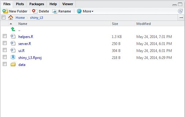
helpers.R
コロプレスマップ(choropleth maps)を作成するためのRスクリプトをダウンロードします。
shiny学習用に作成されたRスクリプトがrstudioのWebサイトにあるので、これをダウンロードします。
http://shiny.rstudio.com/tutorial/lesson5/census-app/helpers.R
ui.R、server.Rと同じディレクトリに格納しておきます。
helpers.Rは、maps, mapprojパッケージを使っていようなので、
インストールしていない場合はインストールします。
install.packages("maps")
install.packages("mapproj")
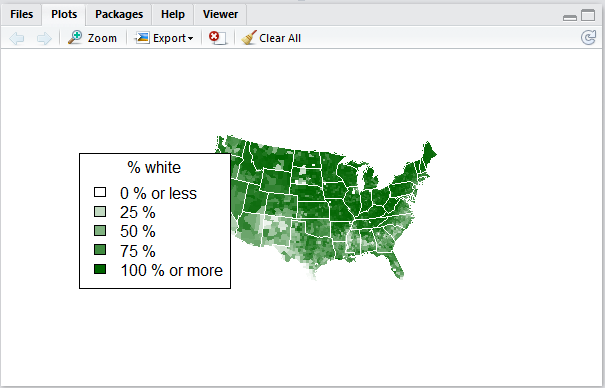
コロプレスマップを表示してみます。
RStudioのconsoleから次のプログラムを順に実行します。
source("helpers.R")
counties <- readRDS("data/counties.RDS")
percent_map(counties$white, "darkgreen", "% white")
RStudioの画面には、こんな感じで表示されます。